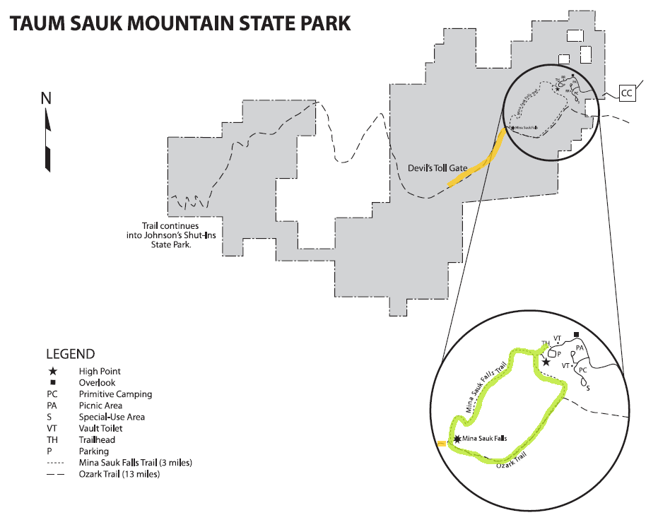
Taum Sauk Mountain State Park is located about and hour and a half south of St. Louis in the heart of the Arcadia Valley. This state park is a perfect example of Missouri’s rugged and unspoiled wilderness.
I met up with my friend, Nicole, and per pup, Dexter, and we hit the road on a bright and sunny Sunday morning.

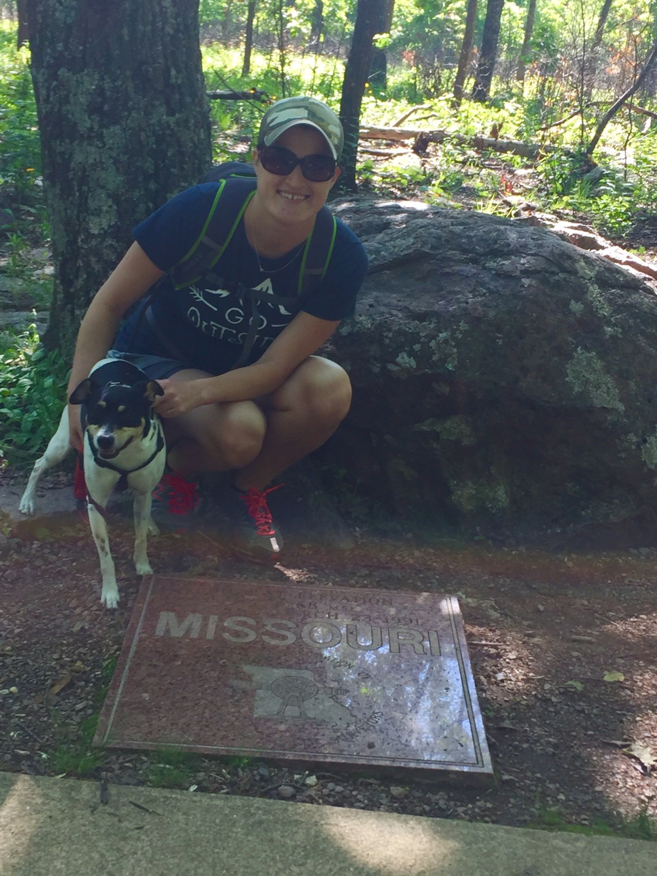
Our goal was to hike the 3 mile Mina Sauk Falls trail with a spur to Devil’s Tollgate. We started out from the trail head and a short paved trail leads to the highest point in Missouri. A nice plaque marks the somewhat ordinary spot =)
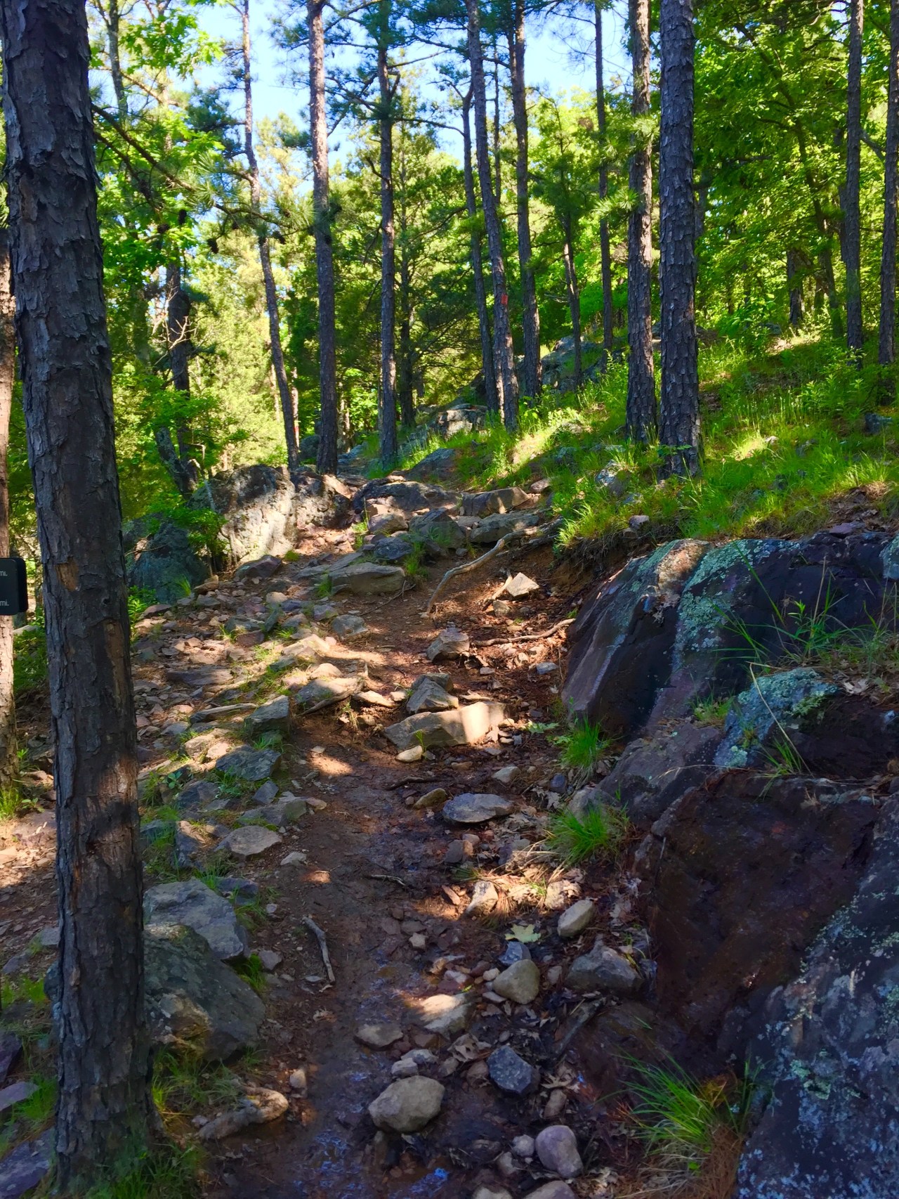
From here, it is 1.2 miles to Mina Sauk Falls. The trail is rugged, rocky and a lot of fun. I love challenging trails and this one did not disappoint. Along the way, you get a stunning view. Far off in the distance you can even see the Taum Sauk Reservoir. We could also see this same reservoir from the Scour Trail at Johnson Shut Ins State Park.

We explored the falls a bit. Mina Sauk Falls is the state’s highest wet weather waterfall. The falls drop over a series of volcanic rock ledges into a crystal clear pool at the bottom. Just before the falls, the Ozark Trail intersects with the Mina Sauk Falls trail. To get a better view of the base of the falls, we hiked down the rugged Ozark Trail.
")
")
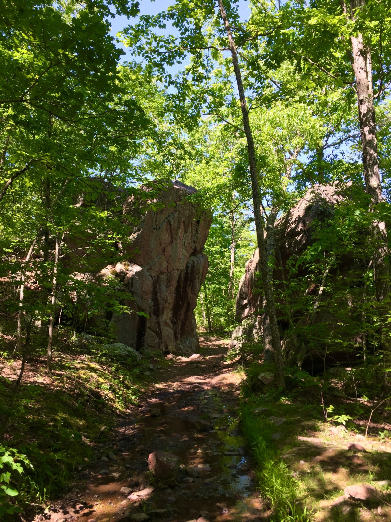
The falls feed Taum Sauk creek and the Ozark Trail parallels the creek. We hiked one mile to Devil’s Tollgate, an eight-foot wide passage between two 30 feet tall rocks.
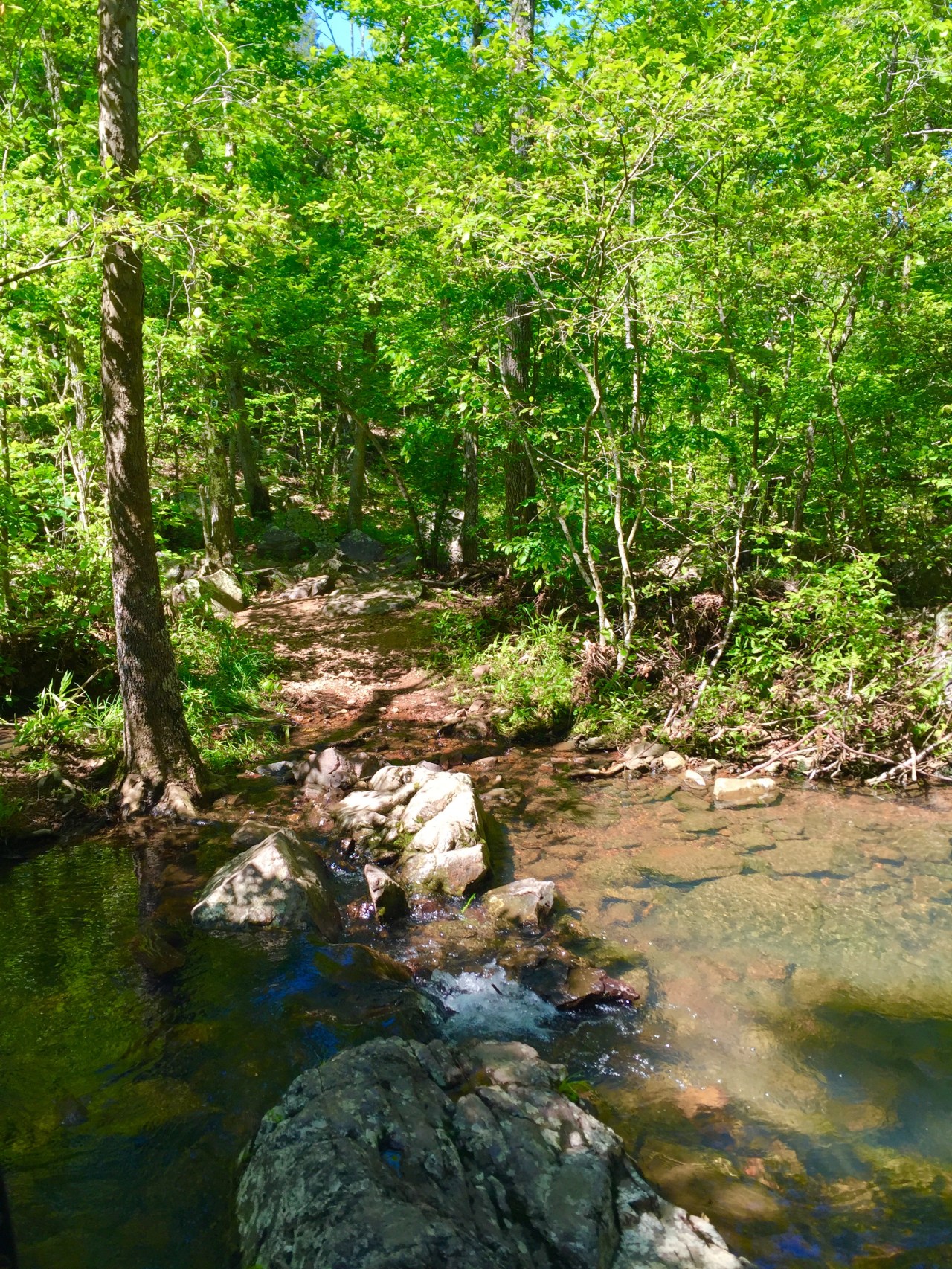
There are even a couple creek crossings.
From here, we turned back and completed the Mina Sauk Falls loop. The rest of the trail leads over rocky glades and back to the parking lot.
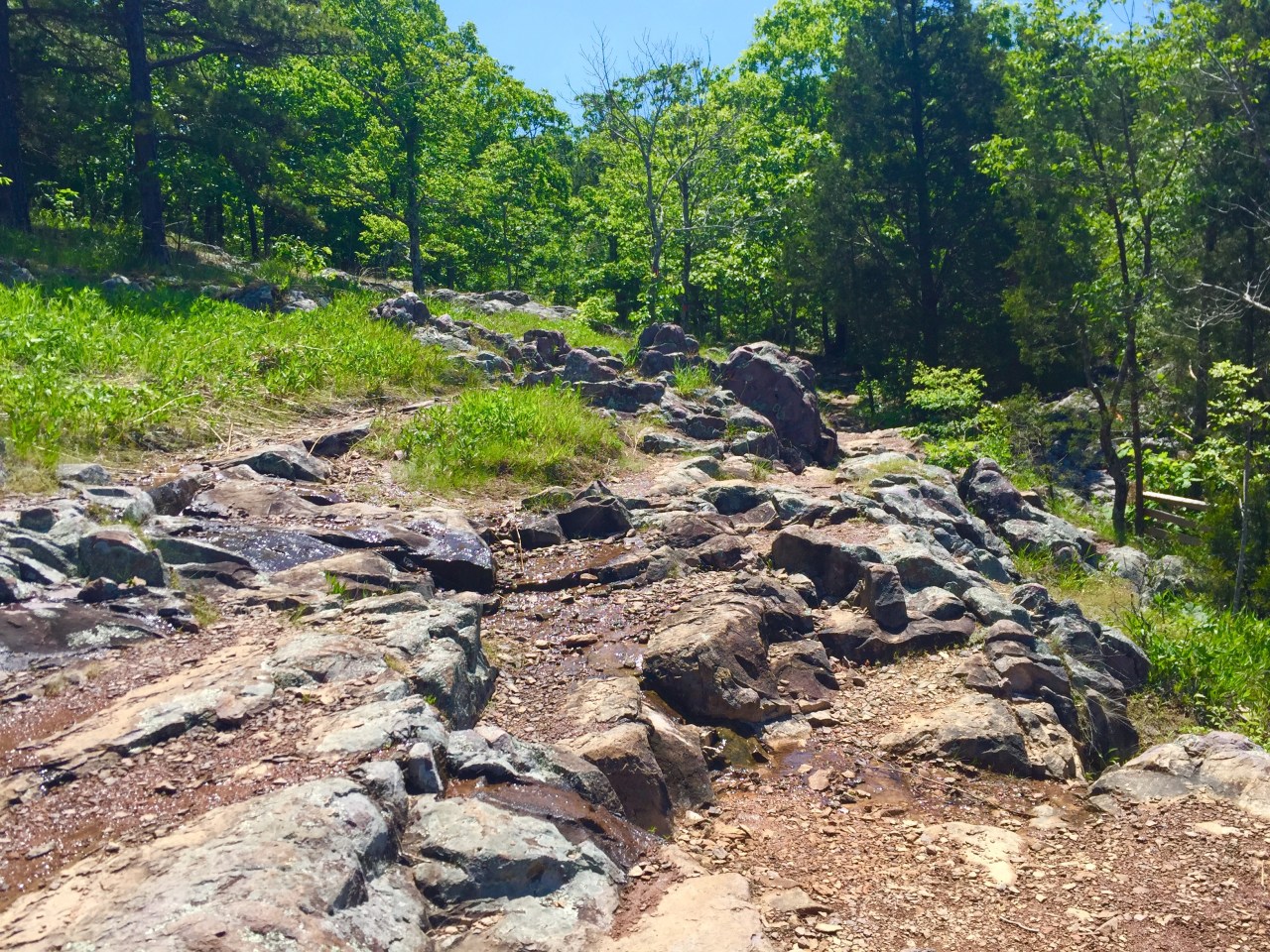
Overall, we hiked about 6 miles. This is probably one of the most rugged and strenuous trails I have ever hiked. Due to the rocky terrain, you have to constantly watch your step. Thanks again to Nicole and Dexter for coming along!

For more information, you can visit the Missouri State Parks website.

Beautiful!!
LikeLike
Once again, you’ve explored a beautiful place close to home! Doggies seem to be good hiking friends too!
LikeLike