Our trip to California mainly centered around seeing Nicole’s parents (who were like a second family to me while we were growing up) and visiting Death Valley National Park. Since this National Park is so vast, we split our sight seeing into two days. Be sure to check out my Day 2 post!
Death Valley National Park is the largest national park outside of Alaska and it is also the hottest, driest and lowest place in North America! For these reasons, we had to check it out!
I think a lot of people enter Death Valley from the Las Vegas side, but we drove from just north of San Diego and it was about a 4.5 hour drive. The most important thing when exploring Death Valley is that supplies and amenities are few and far between and expensive. So be prepared and stop for gas before entering the park.
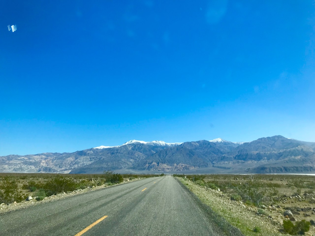
The views along Highway 178 are pretty cool. You are driving through Panamint Valley and the snow-capped Telescope Peak is to your right. This is the highest point in Death Valley at over 11,000 feet! This peak can be seen from most places in the park!
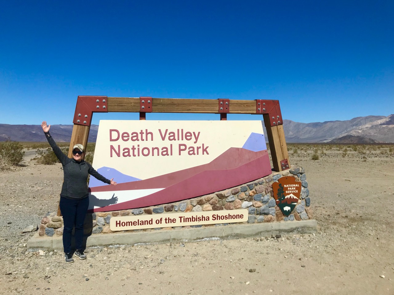
Our first stop was along Panamint Valley Road at the Death Valley National Park sign! After a long drive, we finally had arrived!
From here, we turned left on Highway 190 to visit the Father Crowley Overlook into Rainbow Canyon. It was neat, but not overly exciting. It mentions in the brochure that you might see military aircraft training and we did! A fighter jet flew low and right above us as we were entering the park!

From here, we backtracked and headed East on Highway 190 to Stovepipe Wells. There is a fully stocked General Store, gas station and motel. We spent one night in the National Park and we stayed here. The room was fine for one night, nothing fancy. If staying for more than one night, I might consider something else. I kinda felt like I was tossed back in time and staying at a roadside motel along Route 66 =)
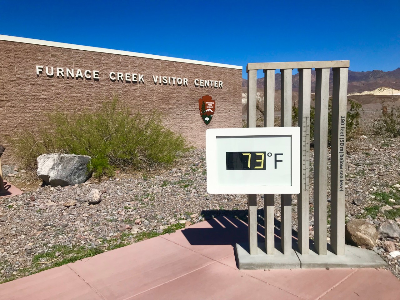
After a short stop for a picnic lunch, we headed to the Furnace Creek Visitor’s Center. Be sure to take a picture of the iconic thermometer!
The best time to visit Death Valley is between November and March as temperatures are bearable. During the summer months, the temperature can reach well over 100 degrees and can be deadly. Even though the temperature was only in the low 70’s while we were there, the sun was very hot.
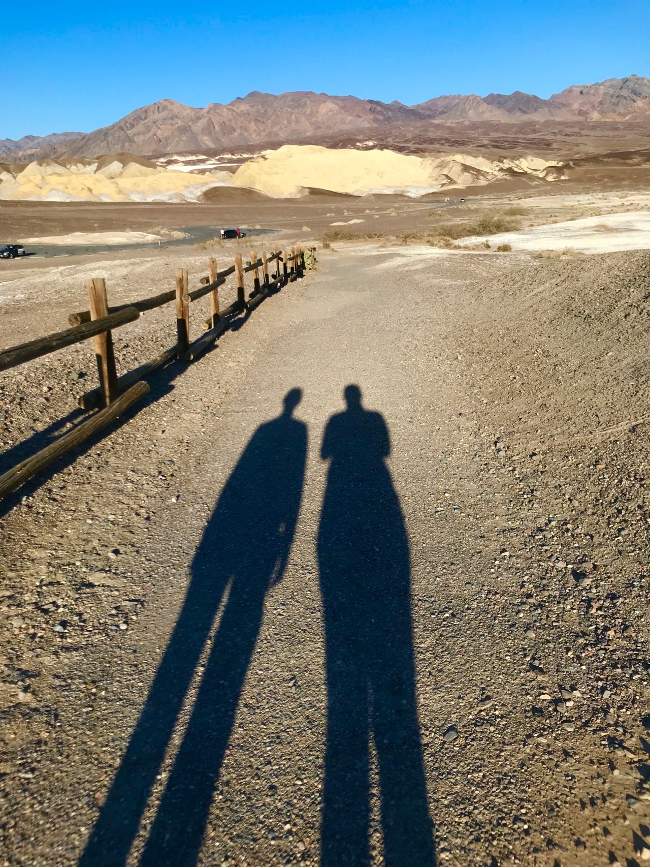
Our next stop was the famous Badwater Basin. We decided to drive to the furthest point of interest on Badwater Road and work our way backwards. Located between the Amargosa Range and the Panamint Range, Badwater Basin is the lowest elevation below sea level at 282 feet.
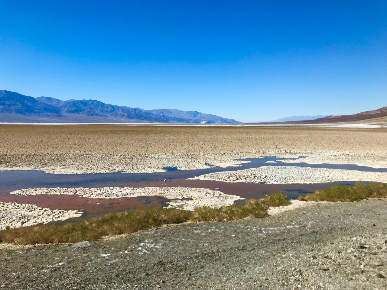

This is a place you must stop when visiting Death Valley. We walked about a mile out onto the salt flats that seem to stretch forever. The landscape is like nothing I have ever seen before!


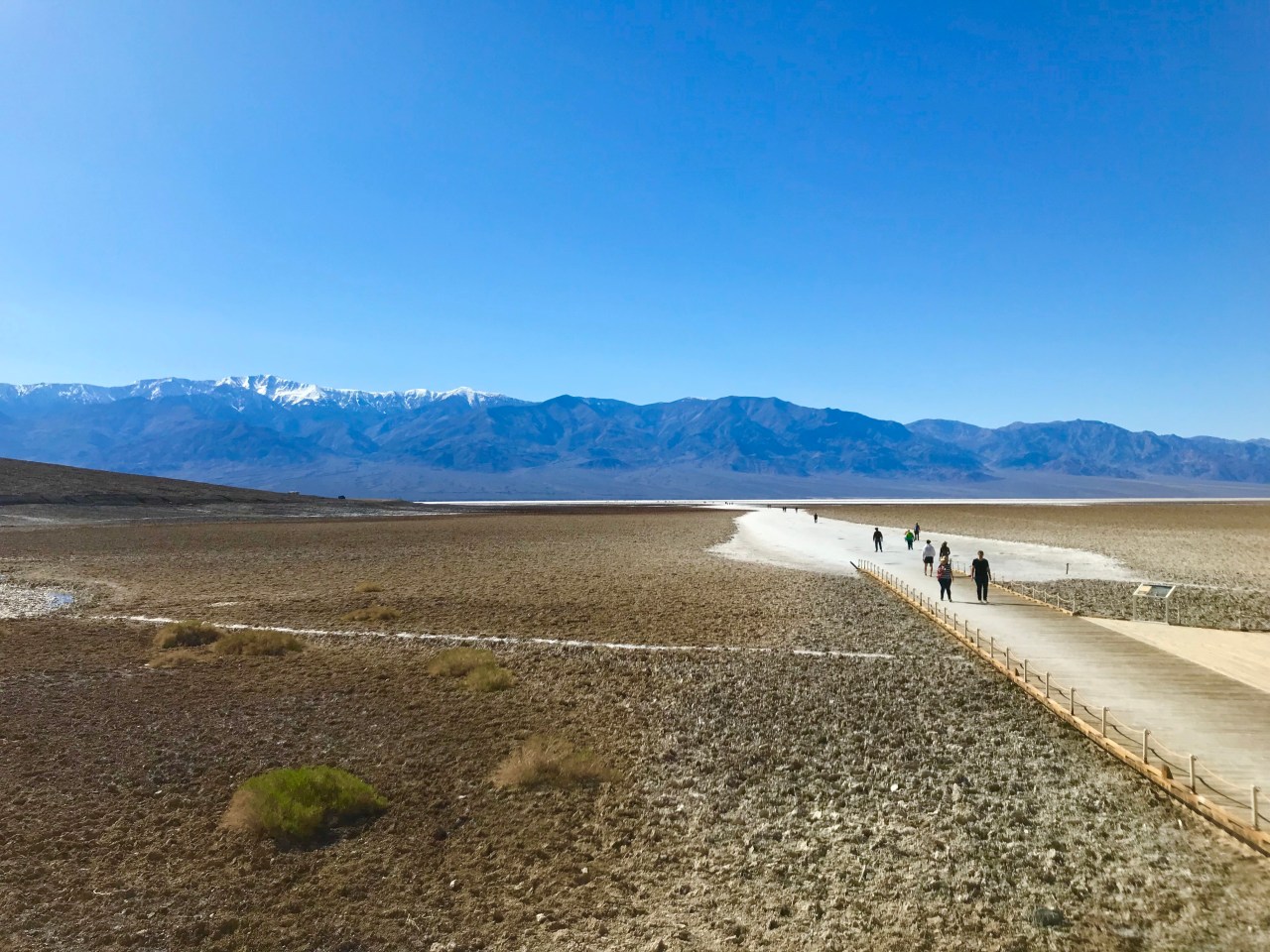
As you are waking back to the car, look up at the cliff ahead and find the “sea level” sign. Technically, you would be underwater right now if you weren’t in Death Valley!!

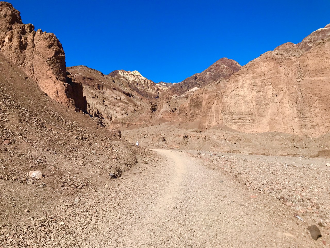
Next, we drove north and stopped at the Natural Bridge hiking trail. A 1.5 mile rock road leads to the trailhead. I had read that some people suggest skipping this hike, but I recommend it! It is an uphill hike, but relatively short at around a half mile one way. As you turn round the bend, the Natural Bridge comes into view.

Be sure to walk to the other side of the bridge and look back at the view! You can just barely see the salt flats through the bridge.
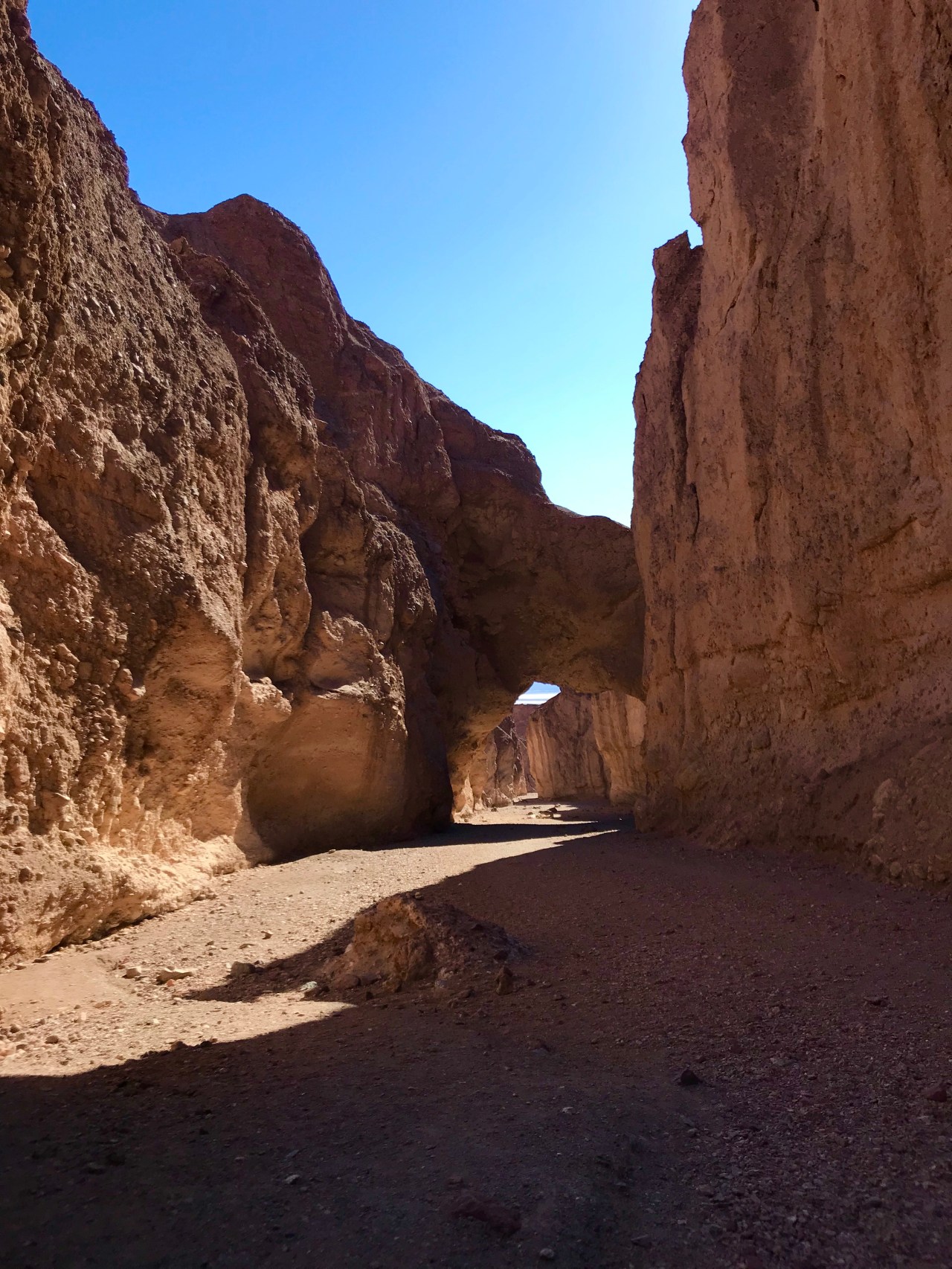
Then walk just a bit further around the bend to see the dry waterfall. I thought this was pretty neat! Over time, water has slowly eroded away the rock. It is in the perfect shape of a cylinder!

The trail continues on, but we decide to head back to the parking lot.
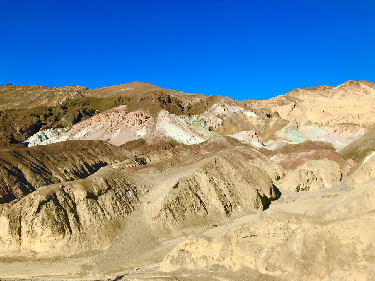
Next, we drove Artist’s Drive which is a 9 mile one way scenic loop along Badwater Road. We stopped at the Artist’s Palette parking lot and marveled at the colorful rock formations. Minerals such as iron, magnesium, red hematite and green chlorite create this colorful display.

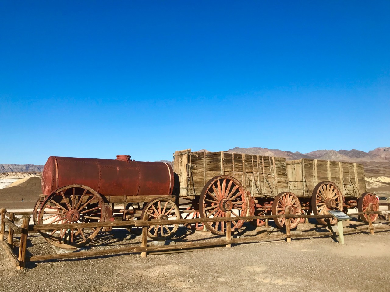
Our final stop for the day was Harmony Borax Works. This historic mining site speaks to the rich history of borax mining in the late 1800’s.
We headed back to Stovepipe Wells for the night so that we could wake up early for Day 2 in Death Valley National Park! We packed a lot into our first day, but it also included a lot of driving since everything is so spread out in the park. Be sure to factor driving time into your trip plans!
Two additional stops along Badwater Road are the Salt Creek Interpretive Trail and Devil’s Golf Course. Both of these areas were closed when we visited due to recent rainfall that caused road closures. Stay tuned for Day 2 in Death Valley National Park!


The shadow pic is awesome! The landscape seems to be out of this world, beautiful but so eerie! Thanks gor letting us tag along!!
LikeLiked by 1 person
Agreed uncle ray!! Something I have never seen before!
LikeLike
So interesting! I also love that shadow pic! Looking forward to day 2!
LikeLiked by 1 person
Very Cool! Always wanted to go there … look forward to seeing Part 2!
LikeLiked by 1 person
You should go! It’s amazing!
LikeLike
Thanks for sharing – very interesting & educational!
LikeLiked by 1 person