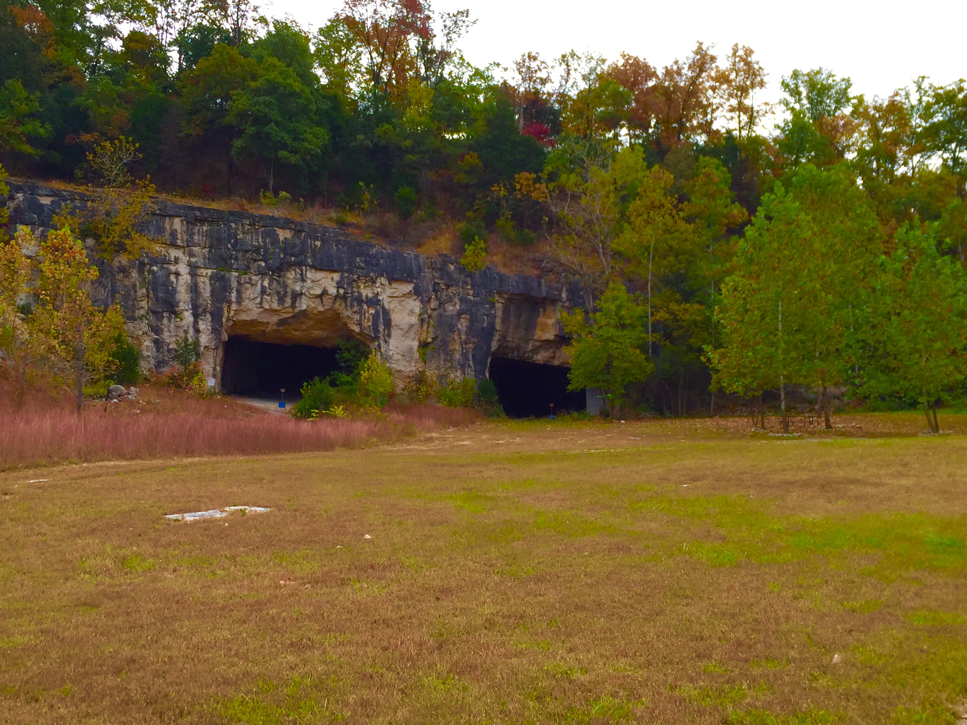
The Salt Lick Point Land & Water Reserve encompasses nearly 600 acres of land just west of the small town of Valmeyer, Illinois. The area is about 30 minutes south of St. Louis. Just off of Bluff Road, there is a large parking lot with some informational kiosks. This site was once home to the Columbia Quarry No 3. and evidence from this quarry site can still be seen today.
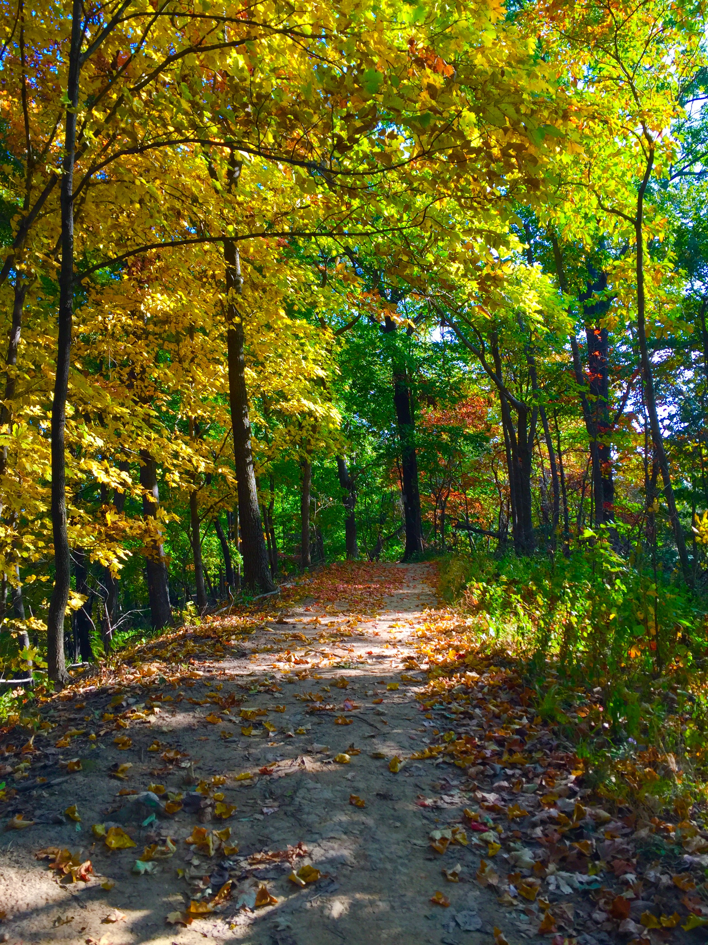
The Salt Lick trail starts out from the parking lot and quickly climbs the steep bluff. This is one of the more challenging parts of the trail. Once you reach the top, the trail gently meanders along the top of the bluff providing glimpses of the farmland below. The trees were showing their fall colors and it was beautiful.
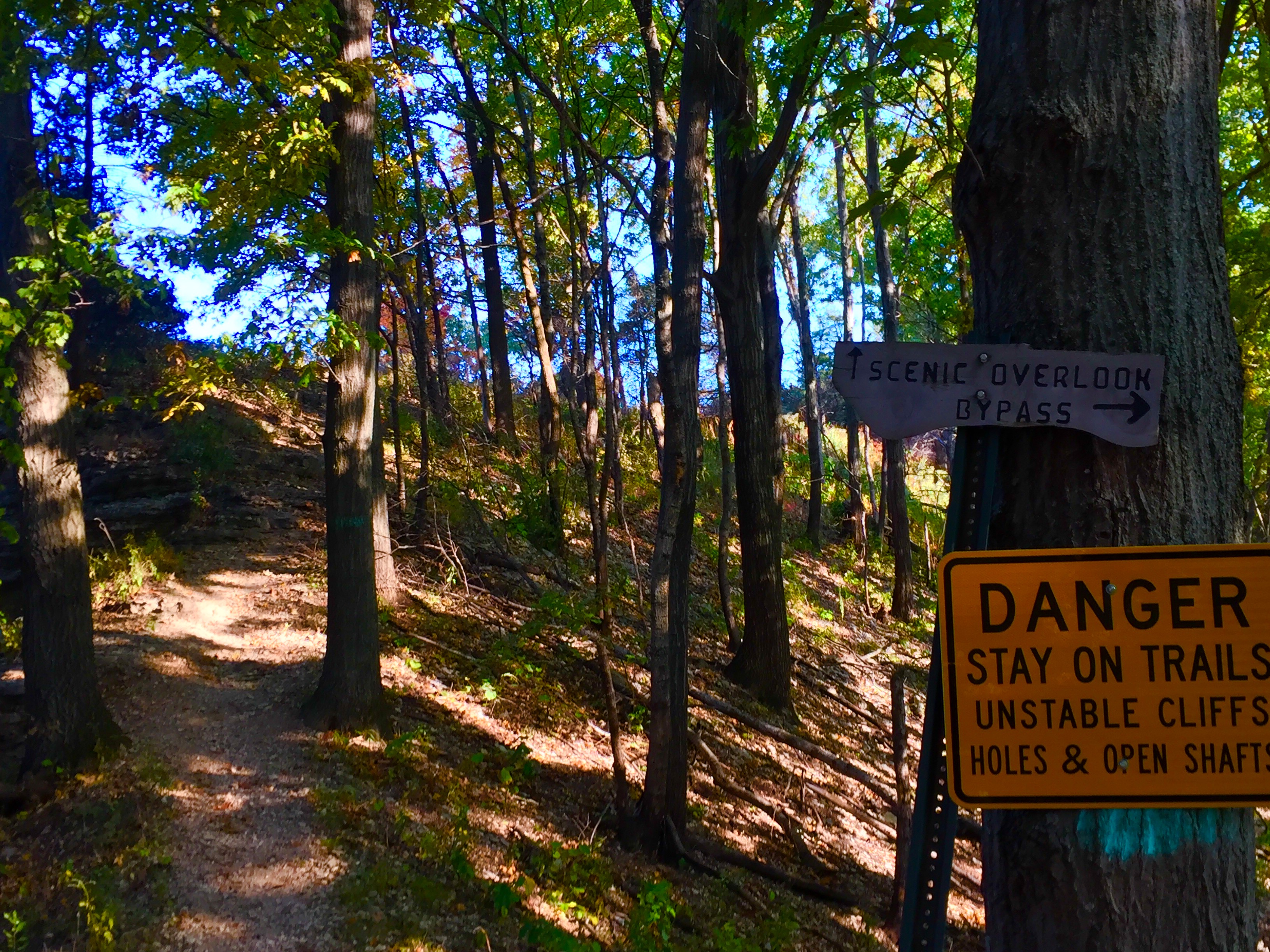
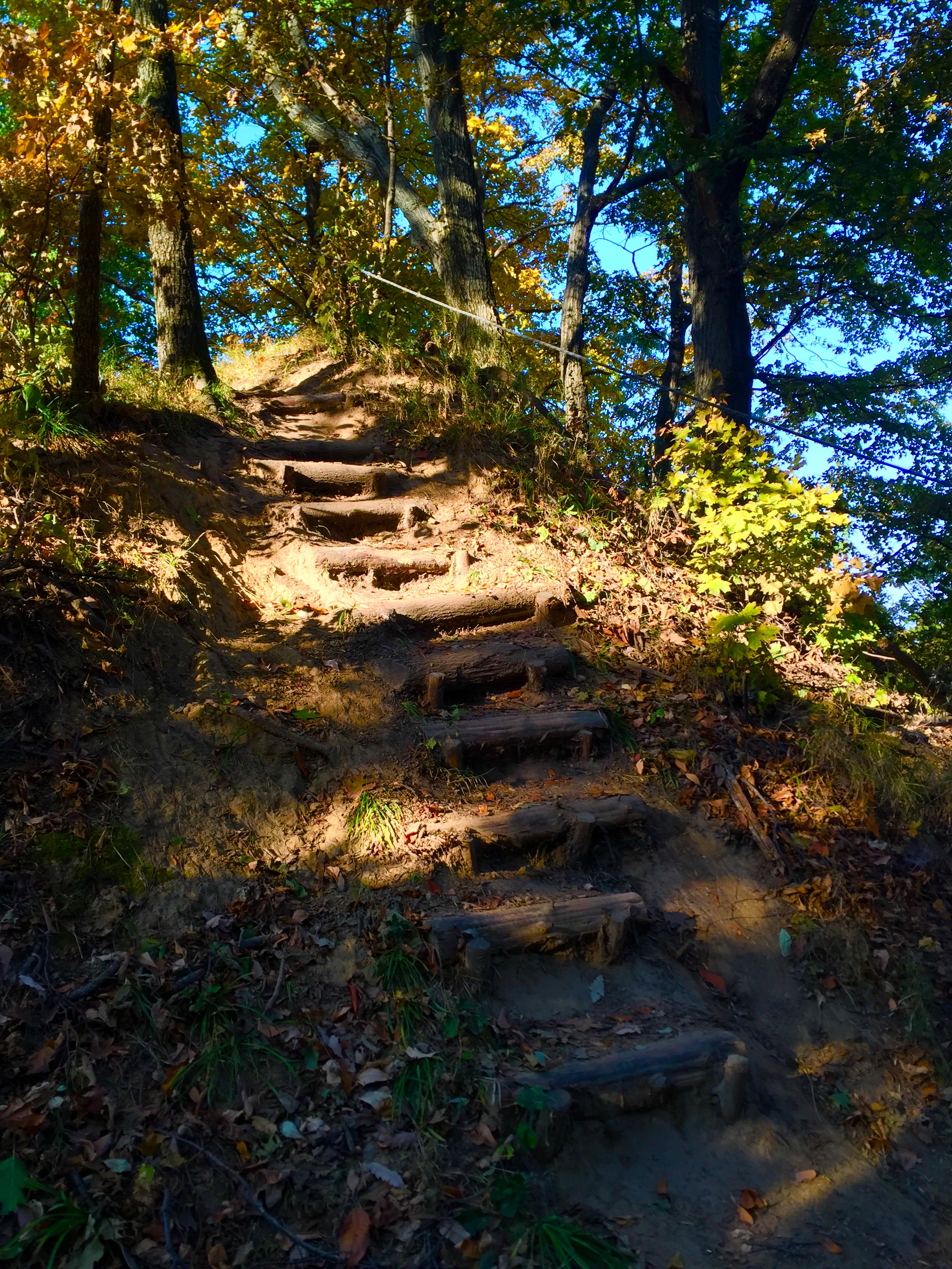
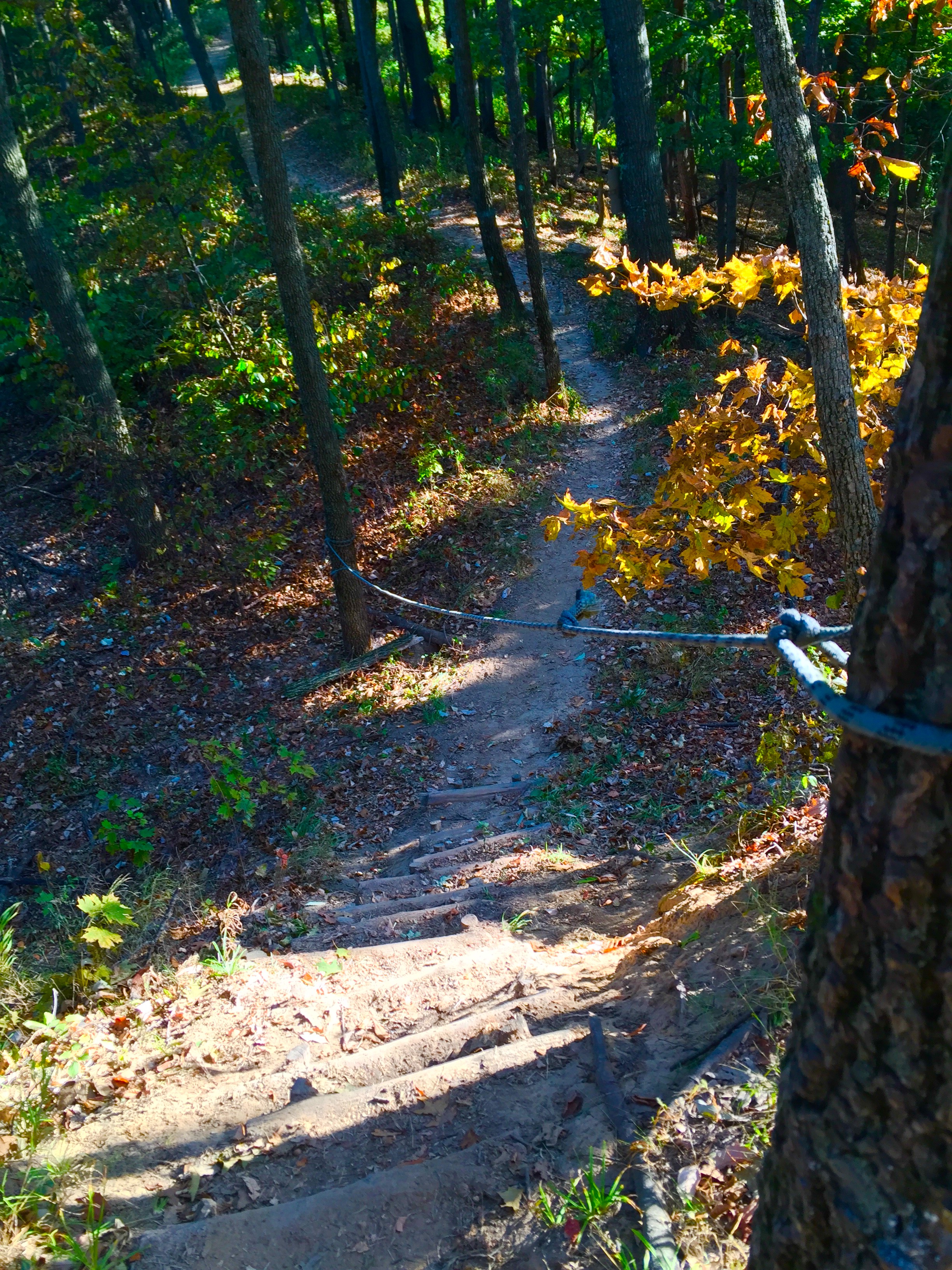
After a while, there will be a sign that points you left to a scenic overlook or to the right to bypass the strenuous hike. The trail to the left is rocky and steep, and it doesn’t really provide you with the best overlook. However, the most fun feature of this trail is coming down this trail on the other side. There is a cable tied between the trees to help you climb down the extremely steep stairs.
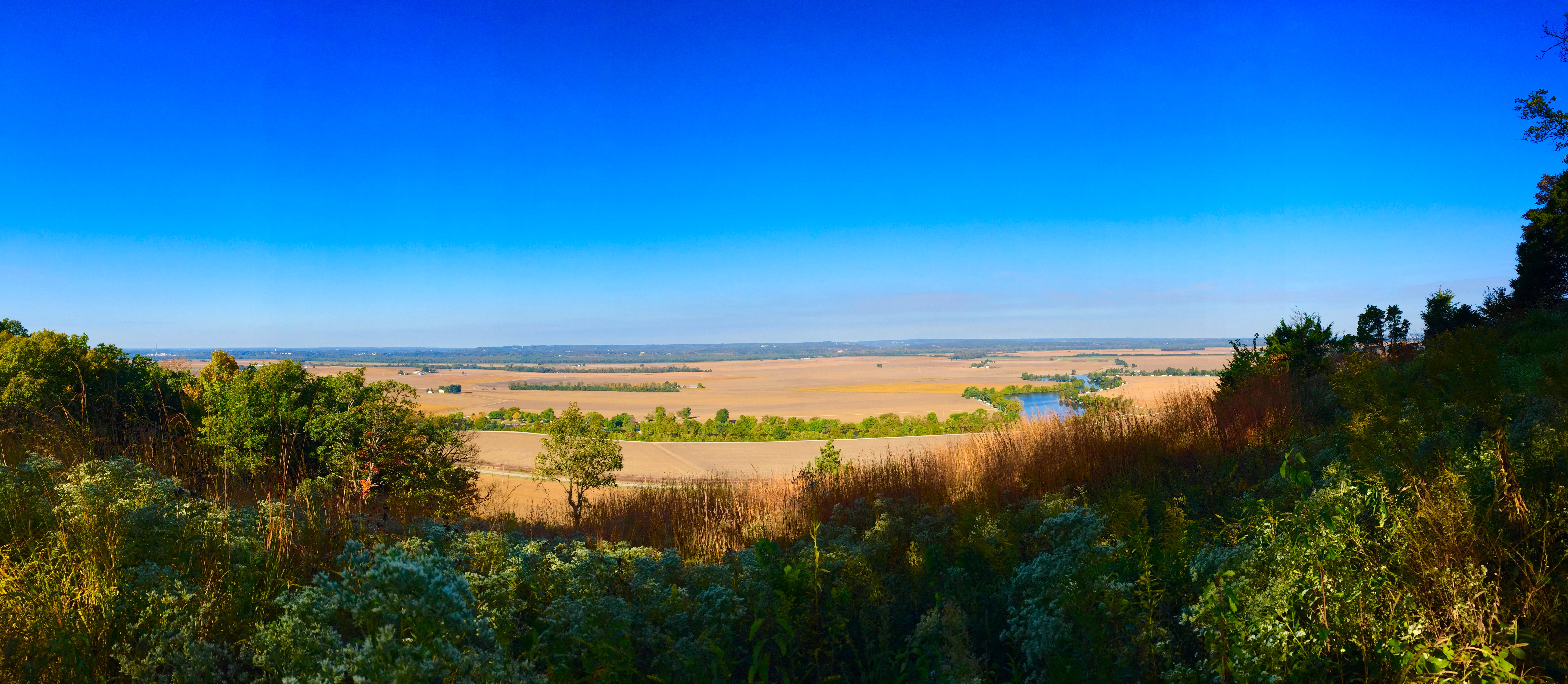
As you continue along the trail, the woods open up to a large prairie. This is the point in the trail where you get the most rewarding overlook.

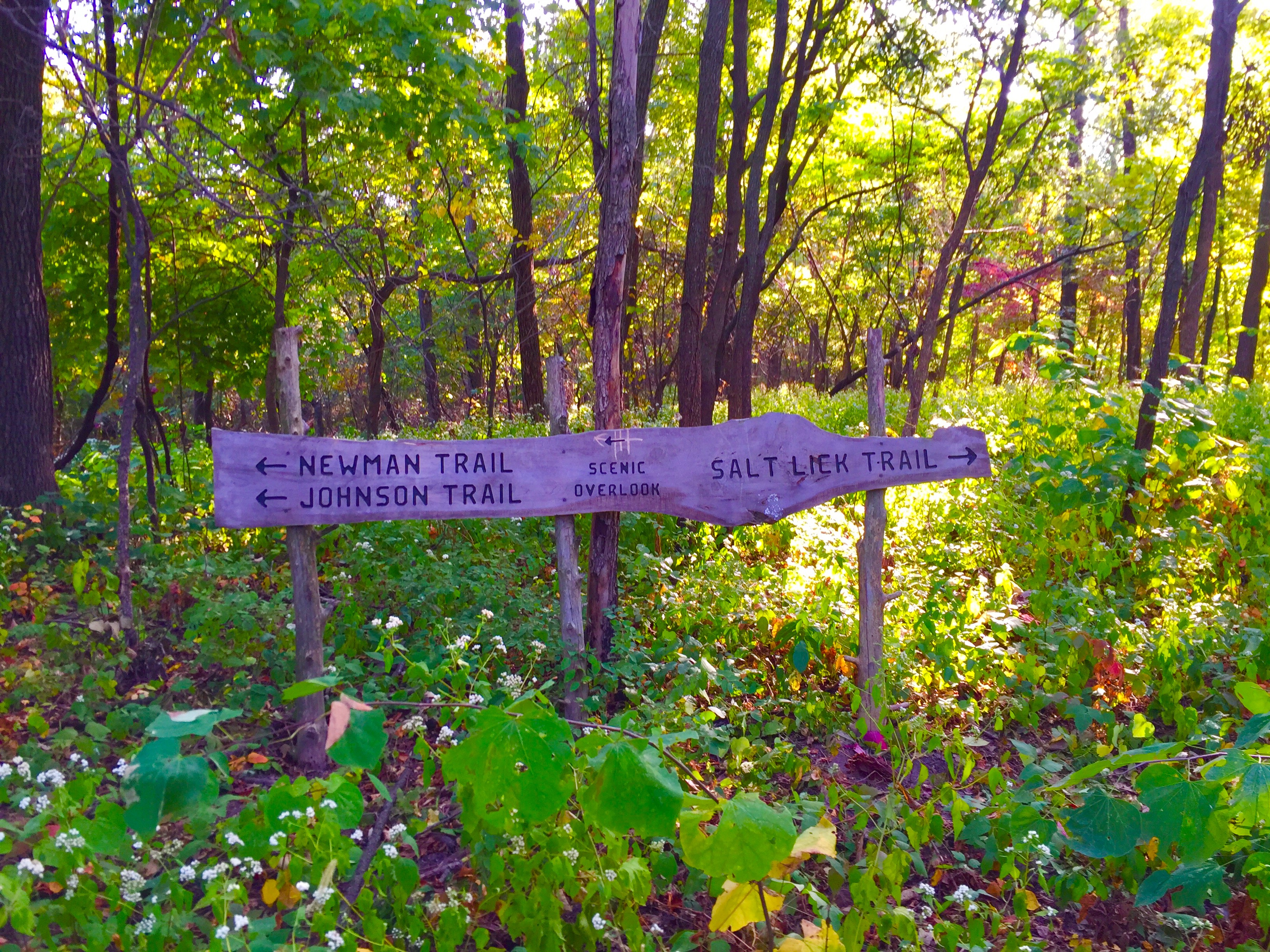
The trail will soon split and the Salt Lick Trail goes back to the parking lot (a very friendly local told us that you have to walk the road back to the trailhead so it is a bit confusing).
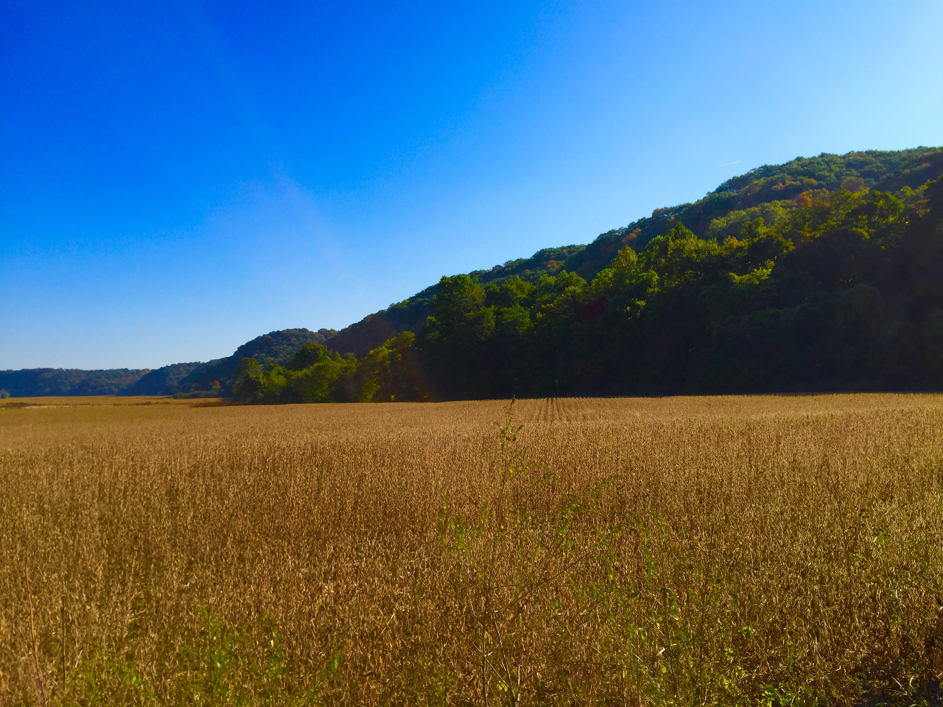
 However, we continued onto the Newman Trail. This trail leads down the bluff with a quick and steep descent. I really liked the view from the bottom. Farm fields surround you and the bluffs tower in the distance.

Here, the Newman Trail heads off to the right and into the town of Valmeyer. We went left on the Johnson Trail and hiked this back to the parking lot. This trail is 1.3 miles long and fairly flat. The bluffs tower to your left and there are large boulders strewn about as if they were just tossed there.


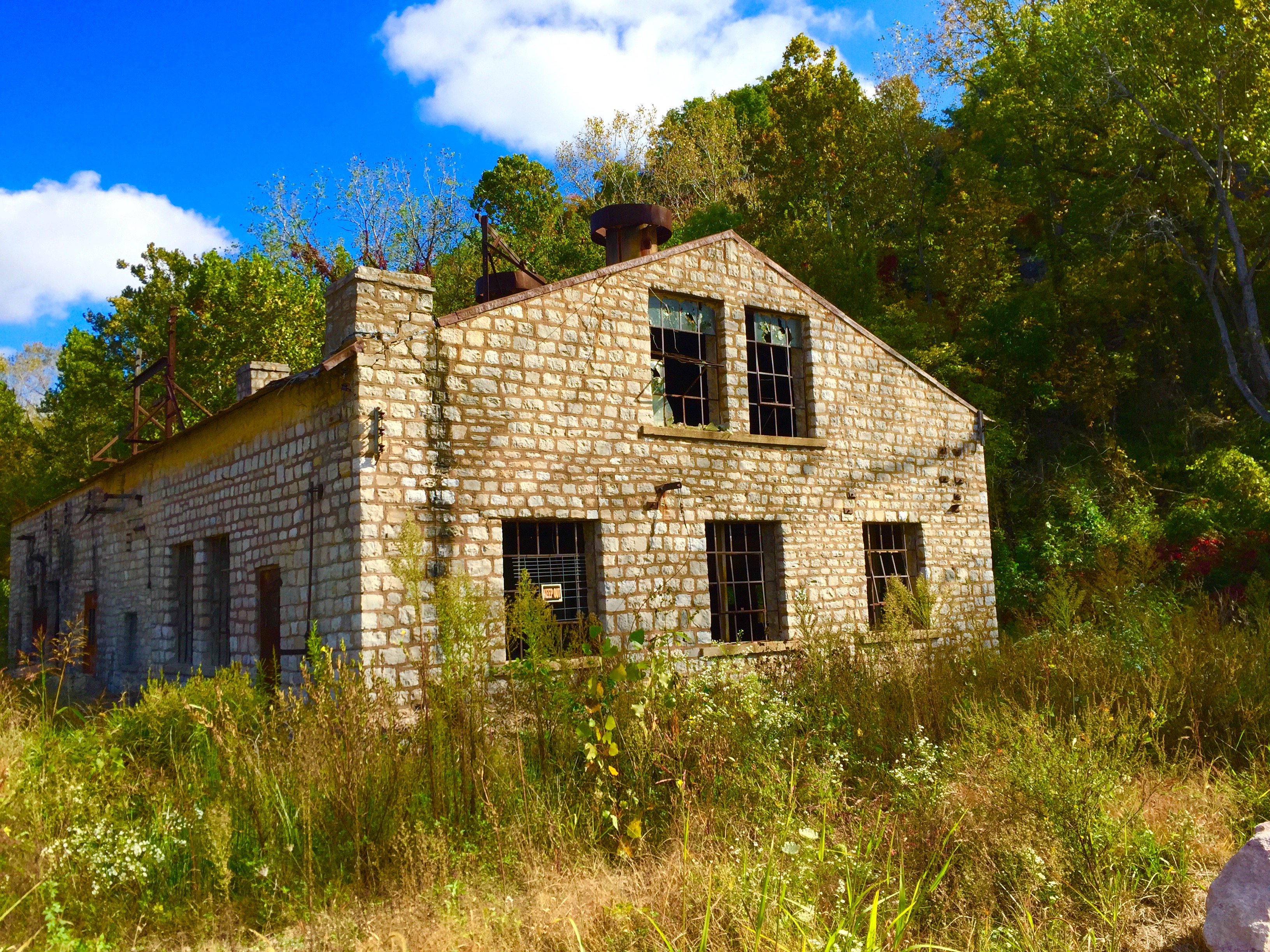
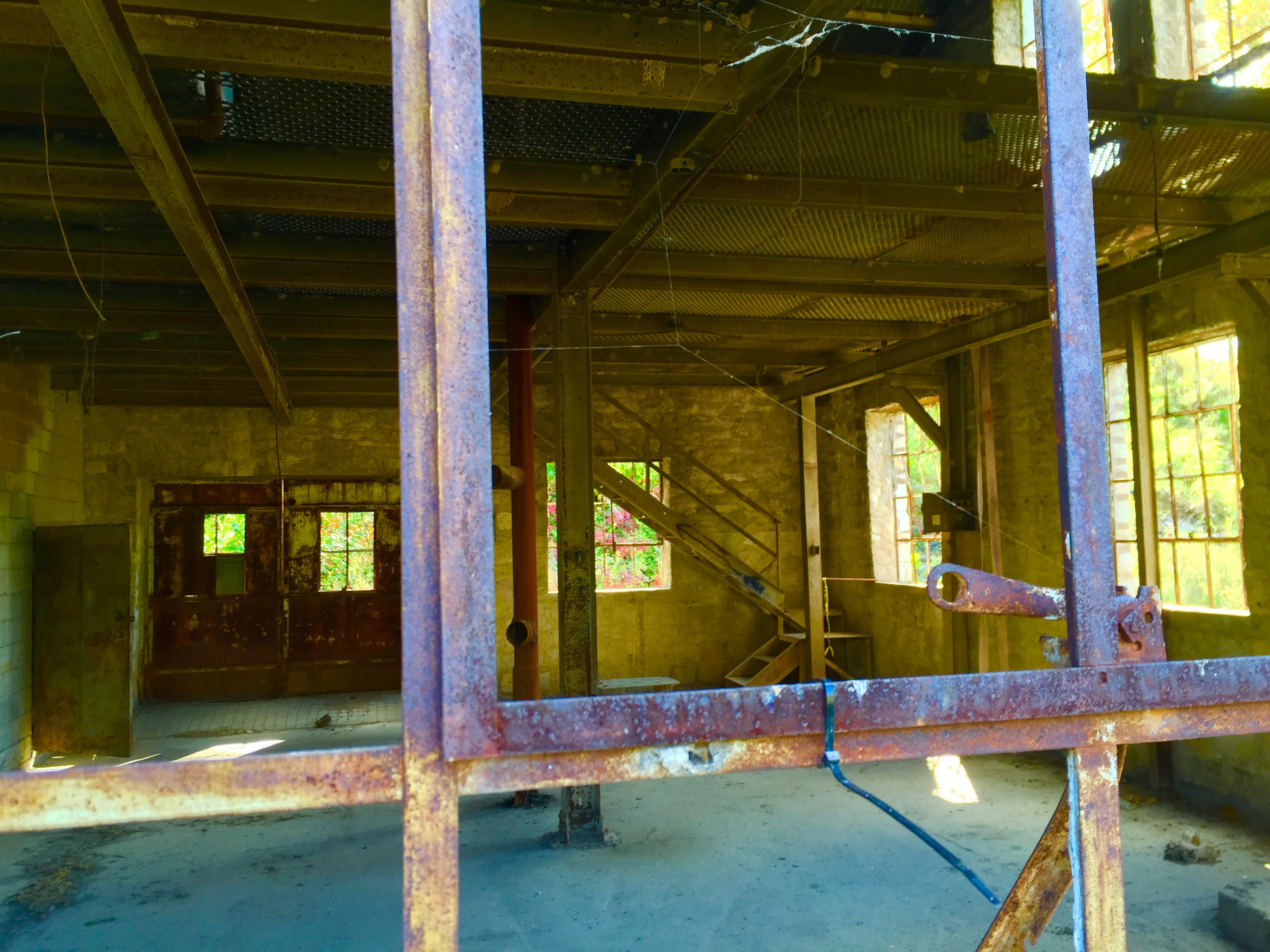
At the end of the trail and at the far end of the parking lot, sits an old quarry building, long since abandoned.

I really loved hiking these trails. I feel like they capture the spirit of Illinois by showcasing the rugged bluffs and the views of the peaceful farm fields.

^ My mom joined me for this hike! ^

Also, it was kind of difficult to find a good trail map online so I took a picture of the one I picked up at the trailhead. The trails we hiked are highlighted below.


A beautiful, interesting hike!
LikeLike
Picture 2 wins!! Well as does the one of you & your mom and the one of the pretty little girl on 4 legs!!
LikeLike
Wonderful post! Thanks for including the map. I couldn’t find much trail information online, so it was nice to have a visual before arriving. This was a great hike.
LikeLiked by 1 person
Thanks for the comment!glad you found the trail map helpful! I couldn’t find one online either!
LikeLike
Johnson trail is beautiful right now with wildflowers blooming! Not sure about maps, but Clifftop is on Facebook. Paul Wrightman Nature Preserve closer to Waterloo IL is also a nice place to hike
LikeLike